Open Data
Open data is data that is openly accessible, exploitable, editable and shared by anyone for any purpose, even commercially. Open data is licensed under an open license. At DataSDR we integrate all these data across different sources and industries to serve your need.
Our Value
We know what data exists
across public, regulatory, and open-access sources.
We know how to extract and process it
cleanly, efficiently, and at scale.
We know how to integrate it
in a way that delivers real value to your software and end users.
Use case 1
Build Your Own Private Google Maps Powered by Open Data
Many companies are concerned about privacy when using tools like Google Maps, where every search and interaction is tracked. That’s why we build custom, secure mapping platforms powered entirely by open geographical data — no third-party tracking, full data control.
Full building footprints
We can offer the footprint of every building across an entire state, complete with aerial photography and 3D visualizations.
Multi-source data integration
We have the ability to take data from multiple sources and put it together in a single platform to deliver value.
Your Google Maps alternative
We can build a customized, private Google Maps-style tool, integrating all available data to meet your unique needs.

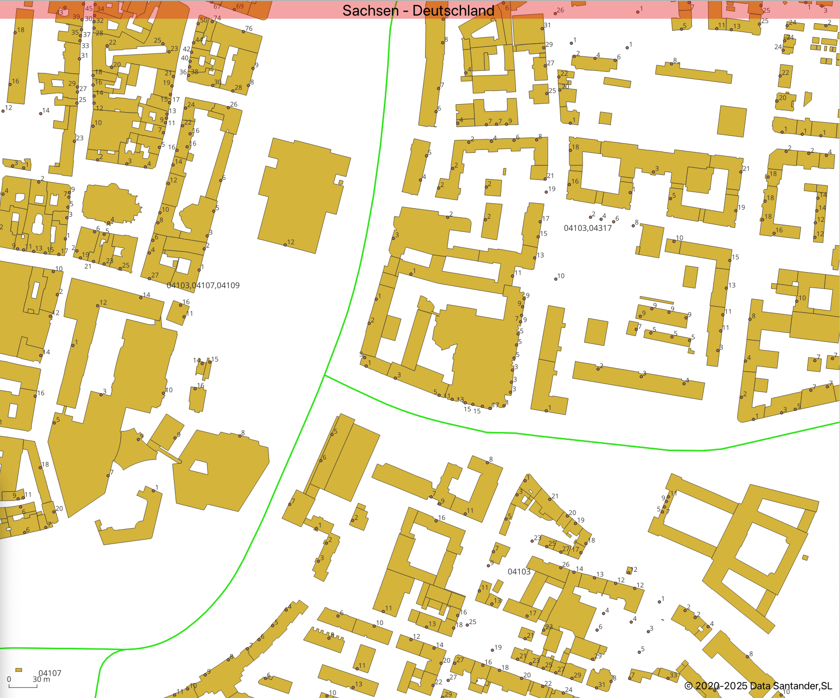
GIS Map – Sachsen, Germany
This high-detail GIS map showcases building footprints across Sachsen (Germany), highlighting structures, block layouts, and administrative parcel divisions. The yellow polygons represent individual building outlines, while green lines indicate boundary separations. Ideal for urban planning, real estate analysis, and infrastructure mapping.
Other use cases
Other High-Impact Use Cases for Open Data Integration
Financial Services- Data Source- SEC (U.S. Securities and Exchange Commission)
Access and integrate extensive public financial datasets, including financial transactions, public company filings, and registered brokers.
Use Case: Build financial intelligence dashboards that track registered brokers, company activities, and market filings in real-time.
Environmental Monitoring – EPA (Environmental Protection Agency)
Access street-by-street data identifying facilities releasing pollutants.
Use Case: Develop interactive environmental risk maps showing pollutant sources at the neighborhood level, supporting environmental health monitoring and compliance efforts.
Business & Licensing Intelligence – Florida DBPR (Department of Business and Professional Regulation)
Visualize millions of licensed professionals and businesses across Florida.
Use Case: Build a detailed property-by-property map showing which licenses are registered to which addresses—supporting market research, local government planning, or B2B sales targeting.
